A DIRT TRAILS WANTED PROJECT
What Becomes of Our Water
An ongoing independent photographic documentary exploring the changing nature of water in the American West.
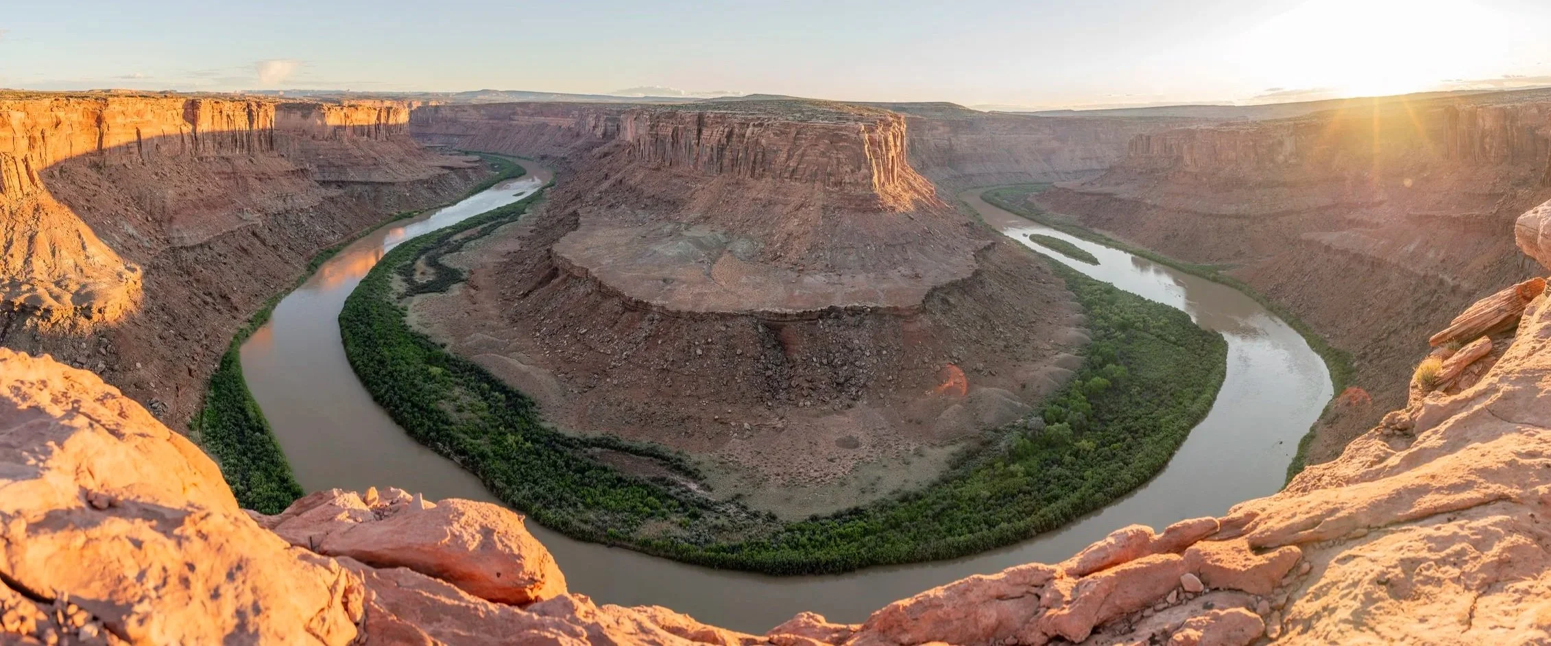
The Colorado River Basin provides water to nearly 40 million people, supporting communities, agriculture, and ecosystems across seven U.S. states and the Mexican states of Baja California and Sonora. Its dams also generate more than 8 billion kilowatt-hours of hydroelectricity annually. Yet for decades, demands on the Colorado River Basin have exceeded what it can reliably provide, and a warming climate has only added to the strain.
In the fall of 2026, this project began by following the Green River from near its headwaters in Wyoming's Wind River Mountains, through the Colorado Plateau to its confluence with the Colorado River, and downstream into Lake Powell. The journey continues along the Colorado River toward its historic delta in northern Baja California, where it once flowed freely into the Sea of Cortez but has largely been cut off from the sea for decades.
As the West grapples with the contrasting extremes of water scarcity and abundance, questions about how we use, manage, and share water have become increasingly urgent, with far-reaching implications for the people and landscapes that depend on it. Through landscape photography, firsthand observations, and historical research, this ongoing project explores these complexities, documenting the relationship between natural water systems and the human decisions that shape them.
The photographs presented here represent a small selection from this ongoing body of work by Brian Marsh.
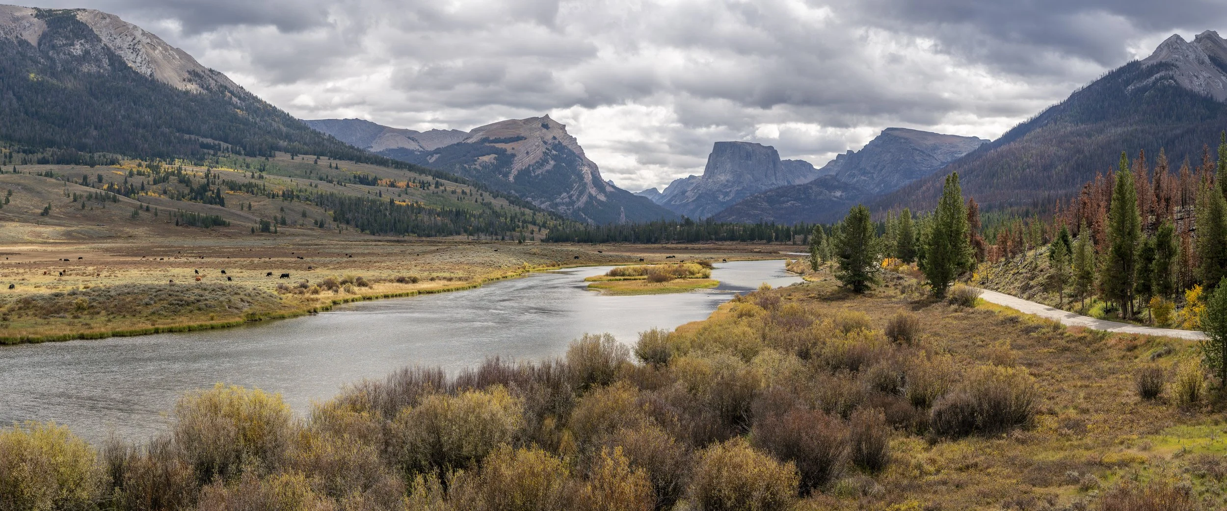
The Green River, September 2026, approximately 17 miles downstream from its headwaters in Wyoming's Wind River Range. The Green River drains a watershed approximately 70% larger than the Colorado River above their confluence. Its headwaters represent the most distant source of the Colorado River system, beginning a roughly 1,730-mile journey toward the Colorado River Delta and the Sea of Cortez. Between 2020 and 2024, an average of 13.1 million acre-feet of water (approximately 4.27 trillion U.S. gallons) was consumed or lost to reservoir evaporation annually throughout the Colorado River Basin. Since the 1960s, the river has rarely completed its journey to the sea, with nearly all its water used or diverted before reaching its historic delta.
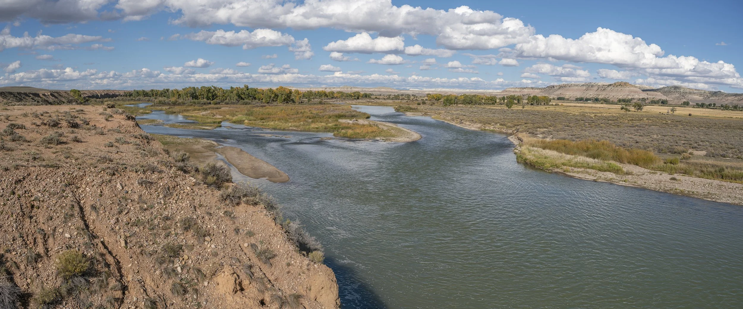
After leaving the Wind River Mountains, the Green drains through open plains in western Wyoming.
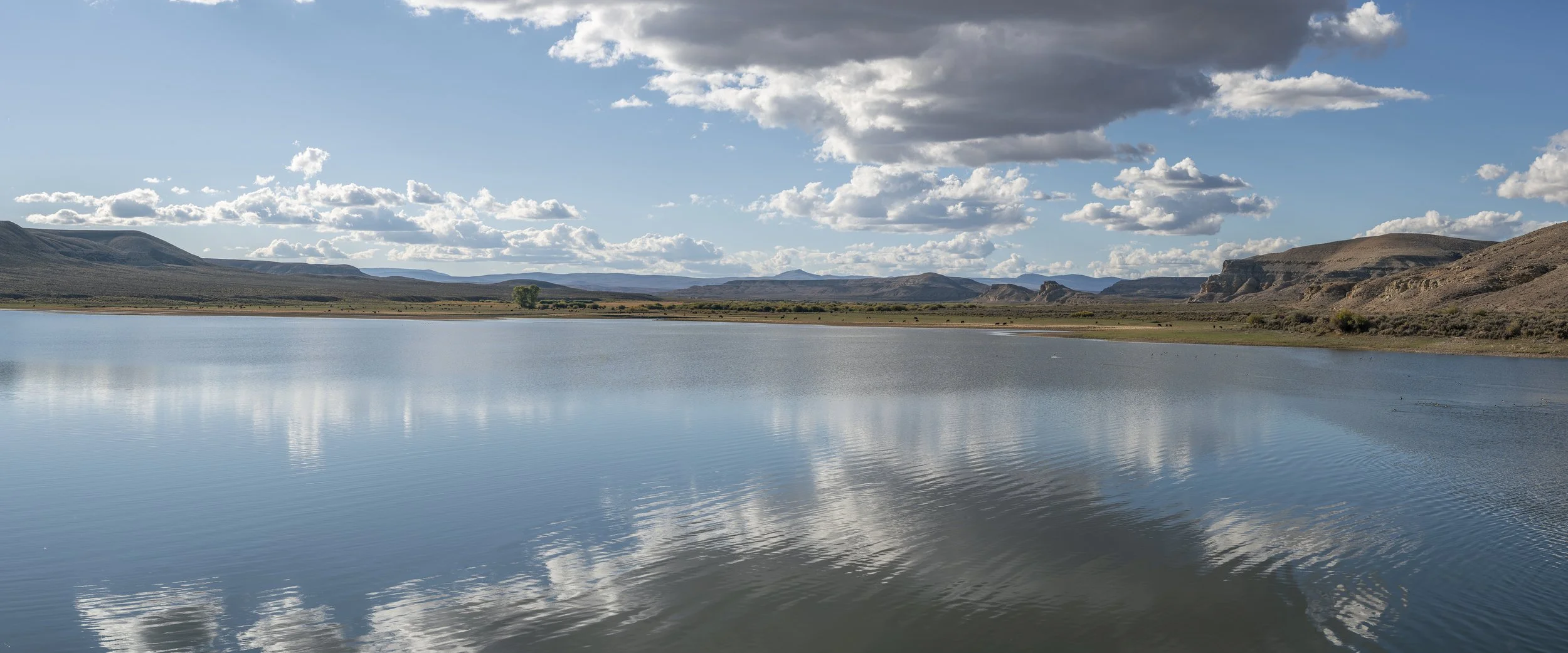
Fontenelle Reservoir, September 2026. Fontenelle Dam is the first federal dam along the Green River, approximately 1,550 miles from the Colorado River Delta
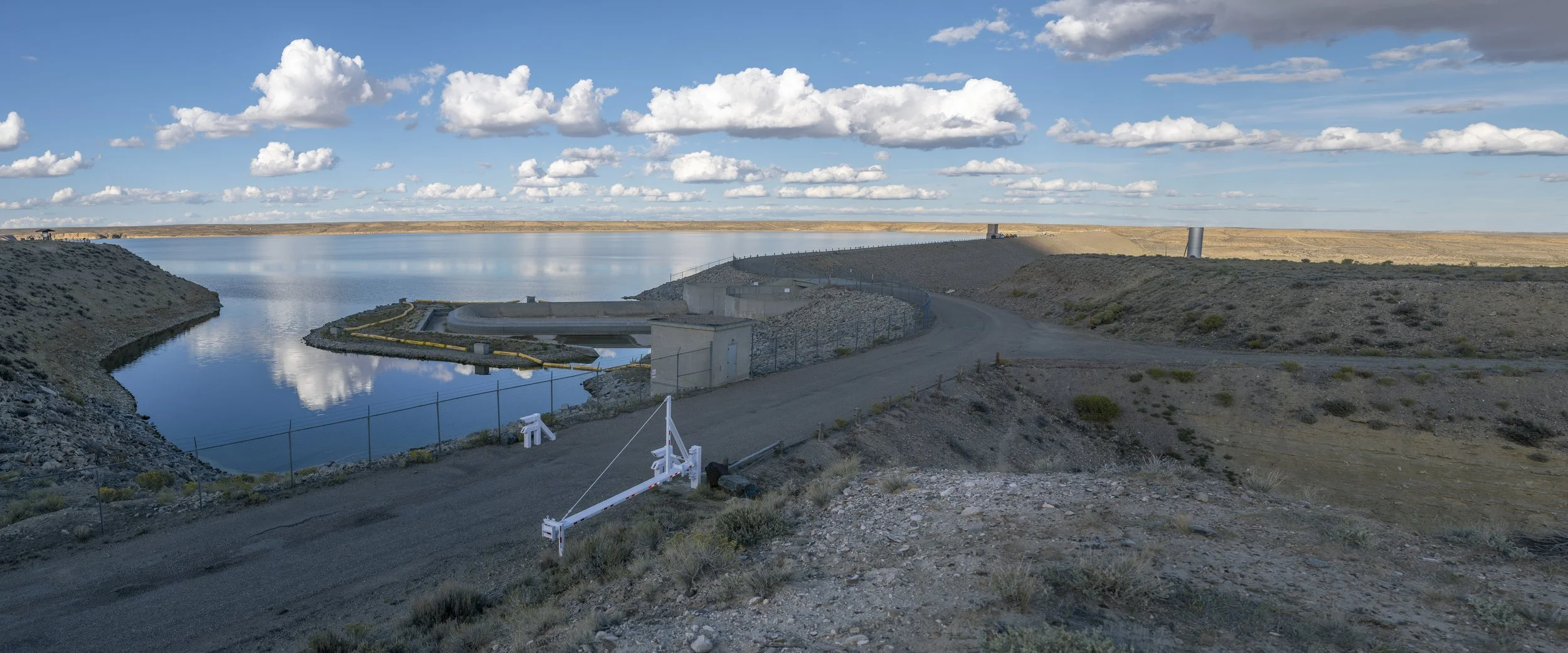
Fontenelle Reservoir and Dam, September 2026, roughly 80% of capacity.
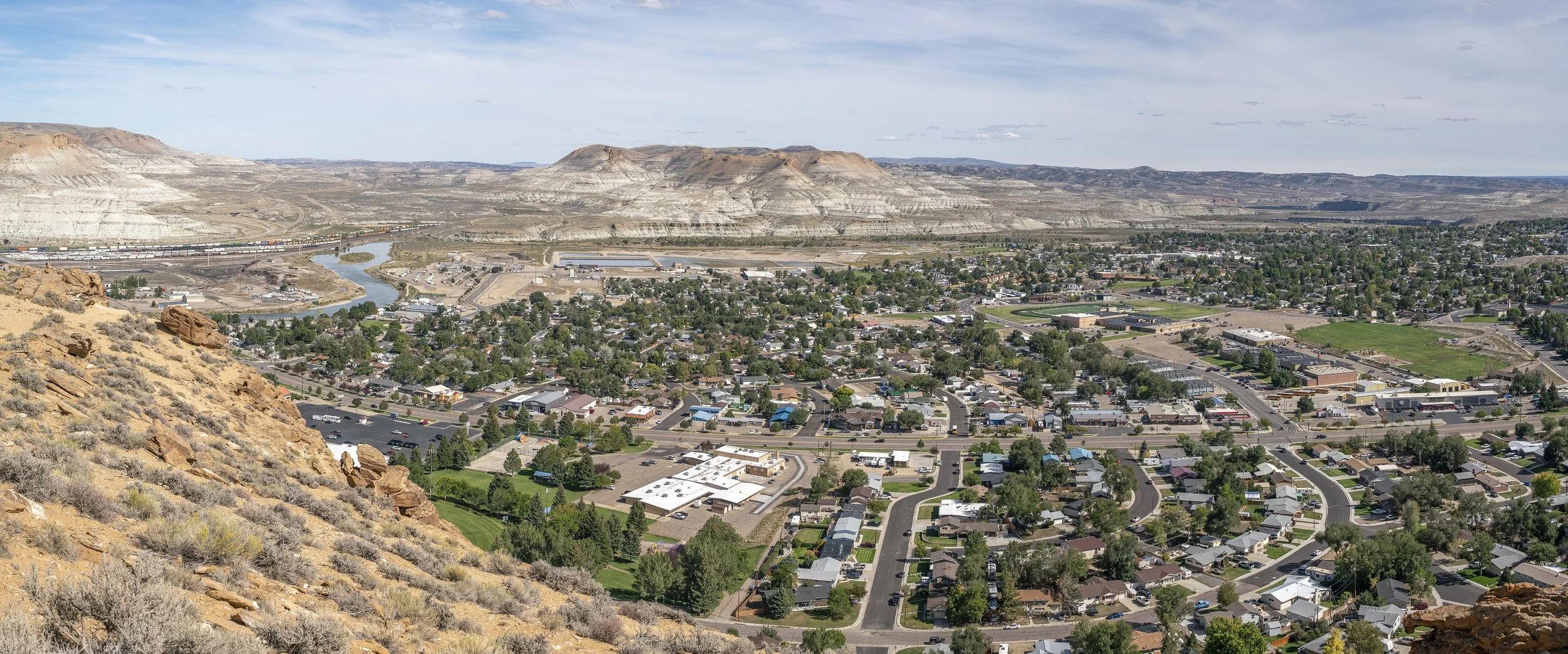
Green River, Wyoming, September 2026. Green River is the first sizable city along the main stem of the Green River, with a census population in 2020 of 11,825.
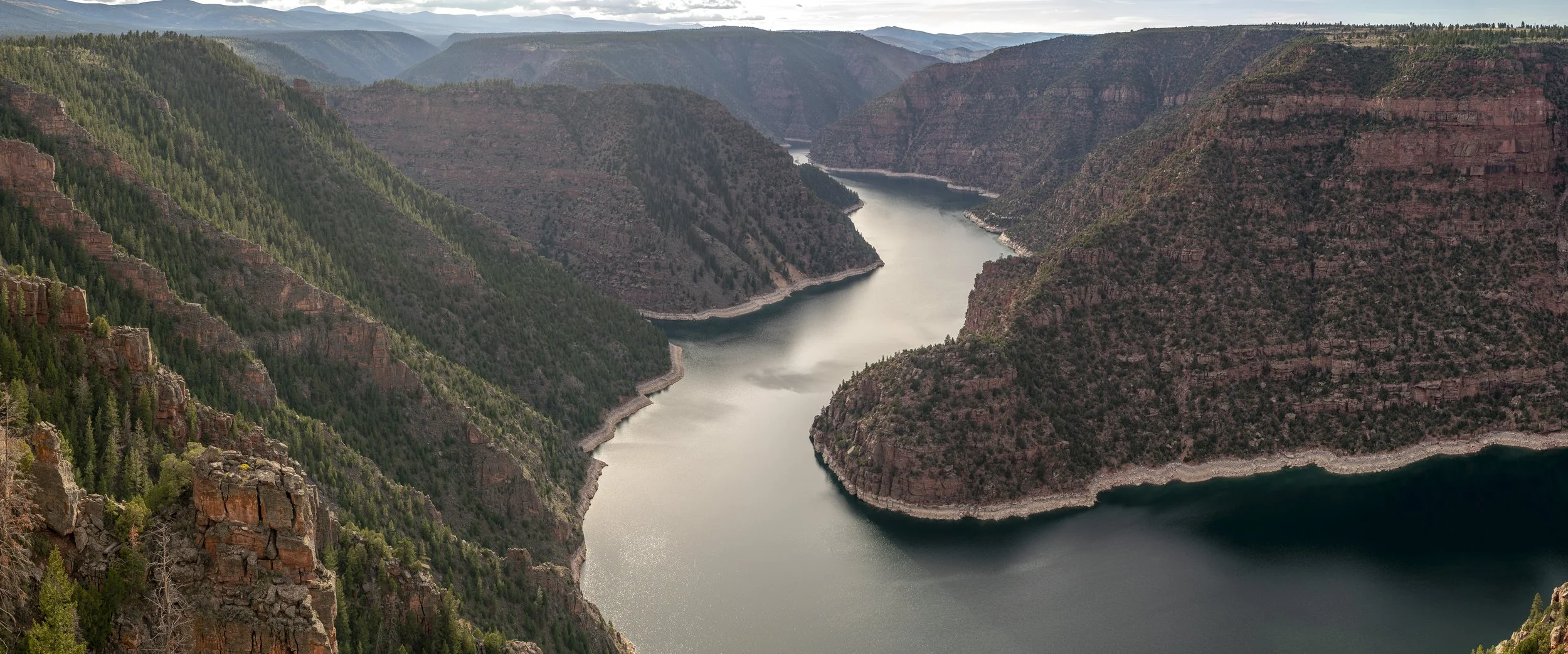
Flaming Gorge Reservoir, September 2026. Approximately 66% of capacity and 32 feet below full pool. Additional water releases from Flaming Gorge were part of an emergency drought-response effort to deliver between 660,000 and 1 million acre-feet of water downstream by April 2027. The releases were intended to help prevent Lake Powell from falling below its minimum power pool elevation of 3,490 feet, the threshold at which Glen Canyon Dam can no longer generate hydroelectric power.
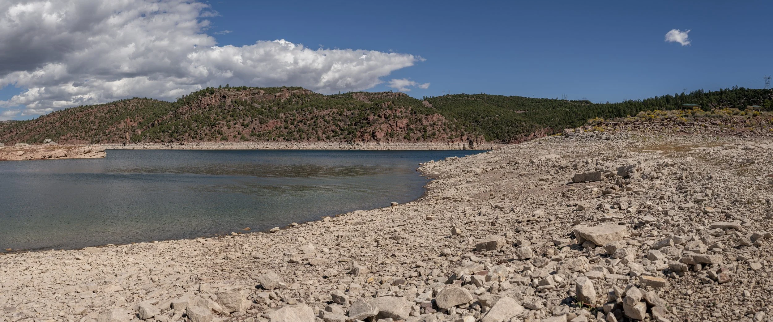
Flaming Gorge Reservoir, September 2026. Approximately 32 feet of exposed bathtub ring.
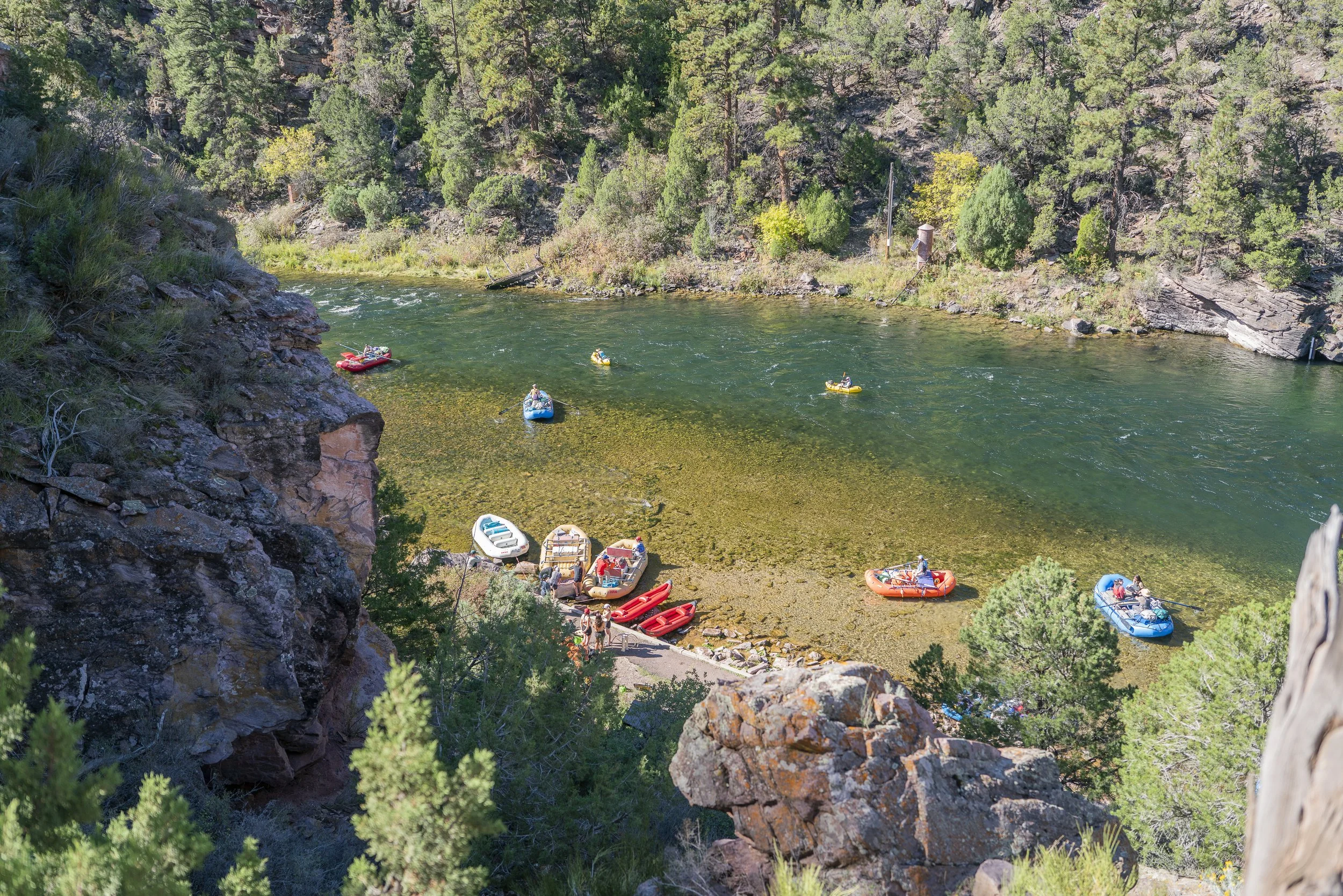
Spillway Boat Launch, September 2026. As part of ongoing efforts to support Lake Powell, Flaming Gorge Dam was releasing approximately 2,170 cubic feet of water per second into the Green River, more than twice the historical average inflow to the reservoir for that time of year.
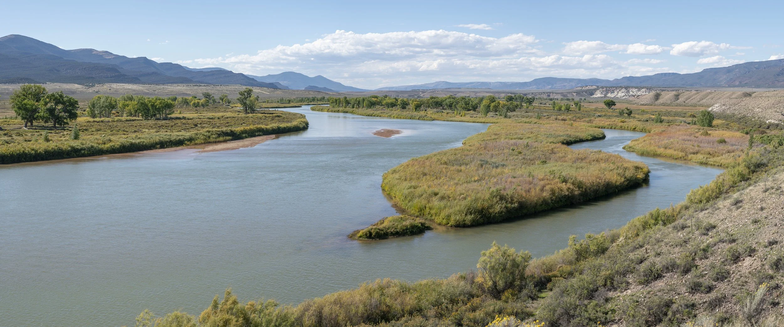
The Green River flows through Browns Park National Wildlife Refuge in northwestern Colorado. September 2026. First considered as a potential reservoir site in 1904, Browns Park was the subject of plans for a dam at the entrance to Lodore Canyon that would raise water levels by approximately 200 feet, flooding much of the valley. The dam was never constructed, and in 1965, Browns Park National Wildlife Refuge was established. Today, the refuge protects approximately 12,150 acres of diverse habitat. Although the valley was spared from inundation, construction of Flaming Gorge Dam upstream in the early 1960s dramatically altered the river's natural flow. Seasonal spring floods that once replenished the valley's wetlands were greatly reduced. Today, refuge staff pump water from the Green River to maintain wetlands that were historically sustained by natural flooding.
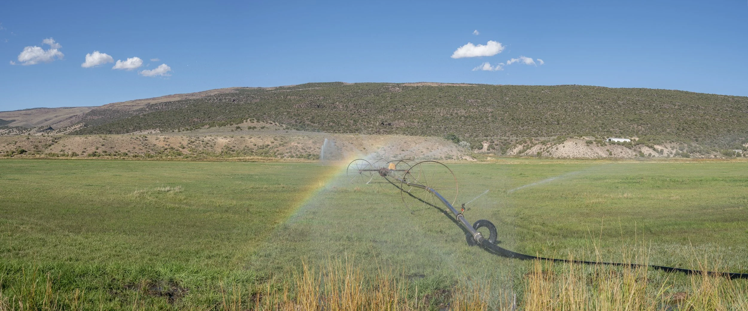
Maybell, Colorado. September 2026. Agricultural irrigation accounts for approximately 75% of estimated water consumption and losses within the Green River Basin. However, not all water diverted for irrigation is consumed. A portion returns to the watershed through surface runoff and groundwater, sometimes months after its initial diversion.
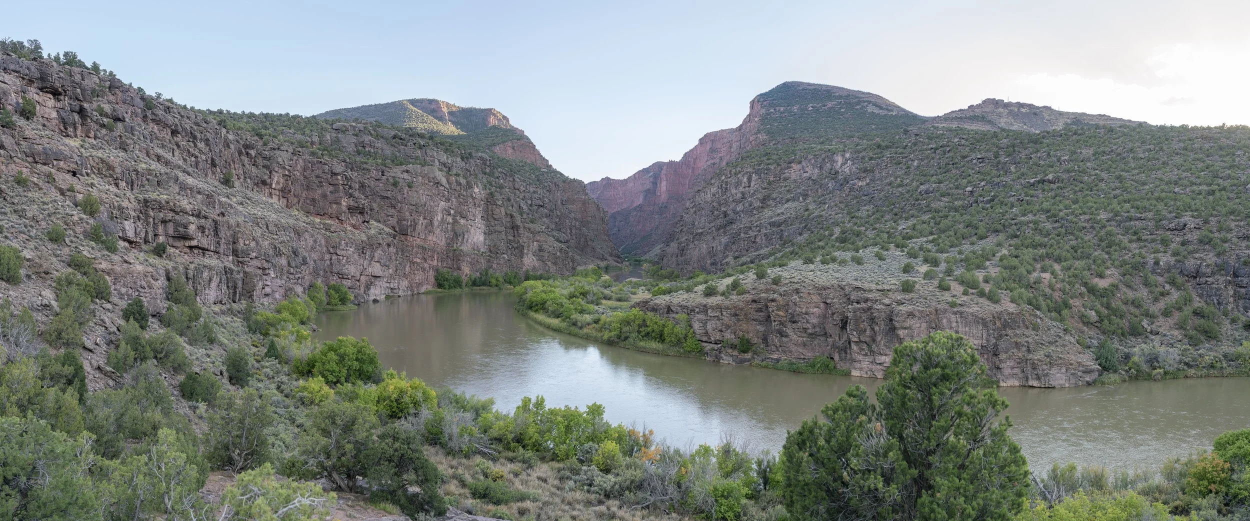
Gates of Lodore, September 2026. Looking into Lodore Canyon, where two potential dam sites were investigated in the early 1900s. One was located near the canyon entrance, with a second approximately 2¼ miles downstream. Neither was constructed, and today this stretch of the Green River lies within Dinosaur National Monument.
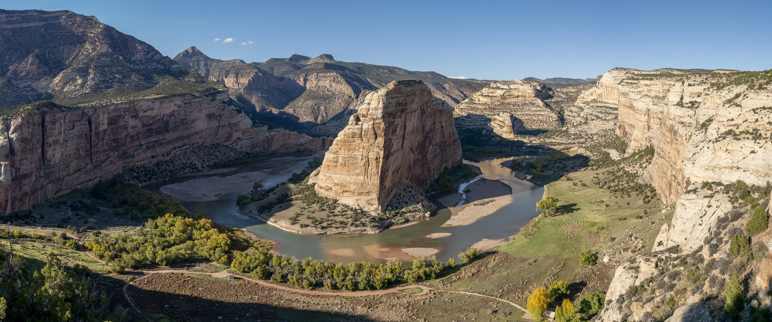
Echo Park, Dinosaur National Monument, October 2026. The confluence of the Green and Yampa rivers, where Steamboat Rock rises approximately 1,050 feet above the river. In the 1950s, a dam was proposed three river miles downstream of the confluence, near the entrance to Whirlpool Canyon. At full pool, the resulting reservoir would have submerged the valley beneath approximately 500 feet of water, covering much of the lower portion of Steamboat Rock. The dam was never constructed.
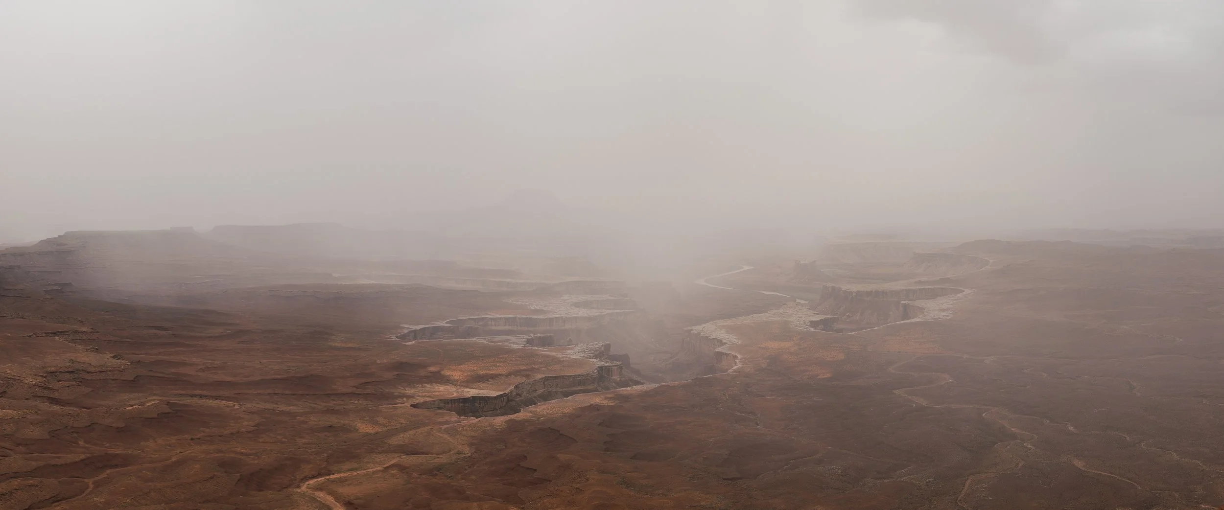
Canyonlands National Park, October 2026. Remnants of Hurricane Rachel drop moisture into the Green River.
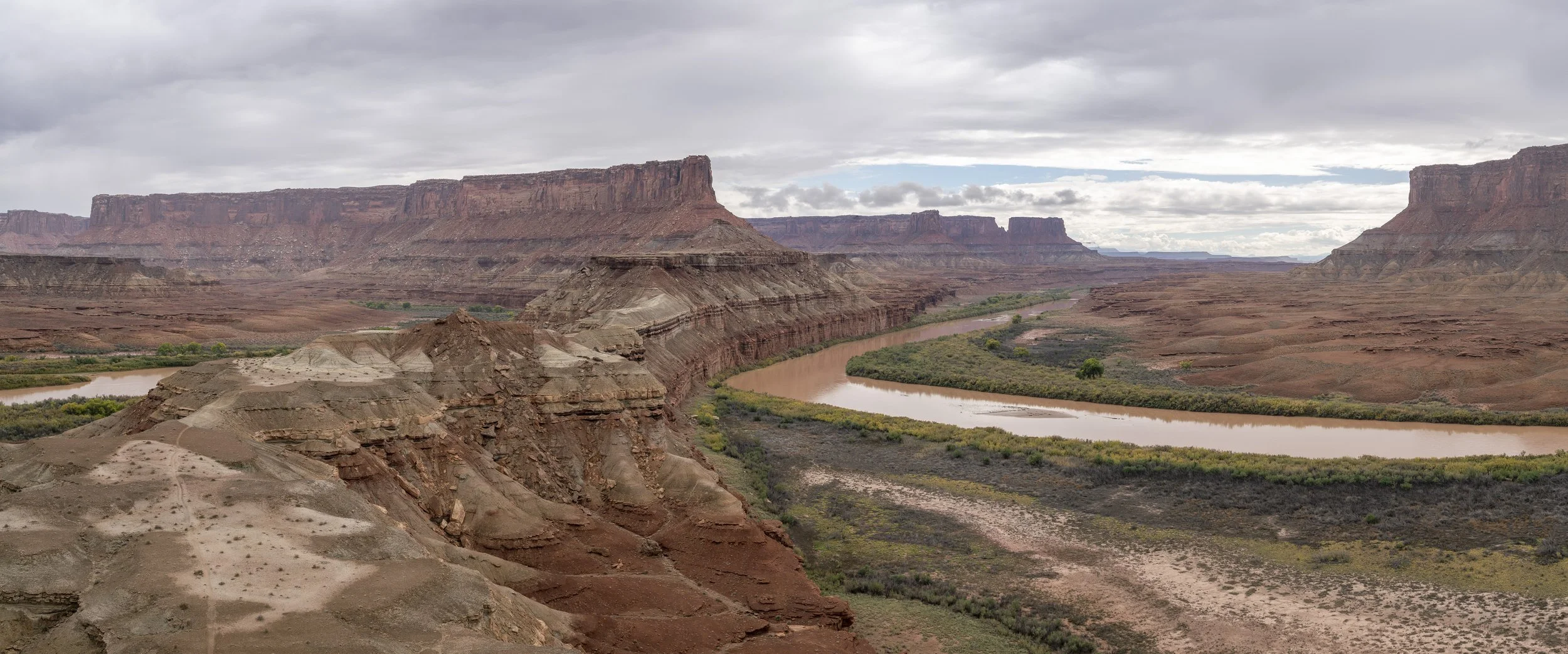
Canyonlands National Park, October 2026. Heavy rains fueled flash flooding in the canyons, turning the river red with sediment.
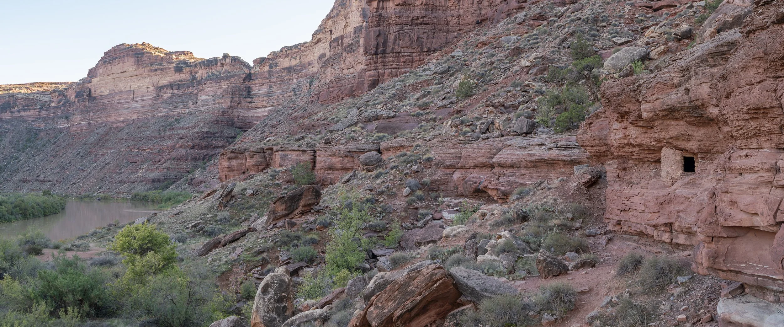
Canyonlands National Park, October 2026. For thousands of years, Indigenous peoples have lived along the Green and Colorado rivers. Between approximately 900 and 1250 CE, communities built stone dwellings and granaries into sheltered alcoves along these canyons. The rivers supported agriculture, including the cultivation of corn, beans, and squash, providing essential resources in an otherwise arid landscape. These surviving structures offer a glimpse into the long history of human dependence on water in the American Southwest.
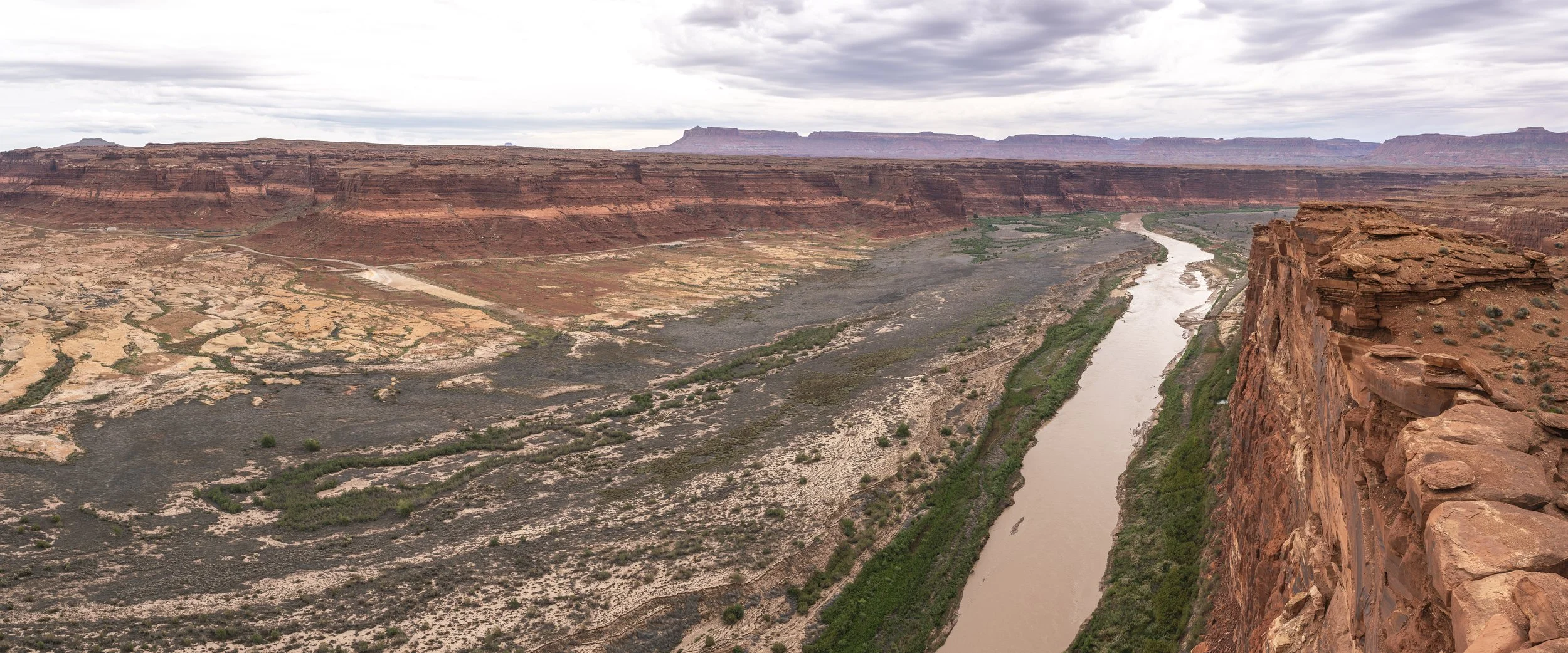
Hite Marina, Utah. October 2026. Once Lake Powell's northernmost marina, Hite ceased water-based operations in 2003 as declining reservoir levels and accumulating sediment made the facilities unusable. Full visitor services were suspended in 2021, and in January 2024, the National Park Service closed the developed area until further notice. During the decades that Lake Powell inundated the area, an estimated 150 feet of sediment accumulated near Hite. As reservoir levels declined, the Colorado River began carving a new channel through these deposits, exposing the former reservoir bed.
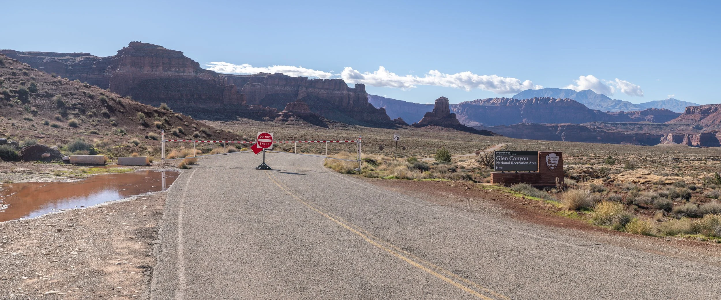
Hite Marina, Lake Powell. November 2026. Once built to serve the reservoir's northernmost reaches, the abandoned marina infrastructure now sits above an exposed landscape, far removed from the water it was designed to access.
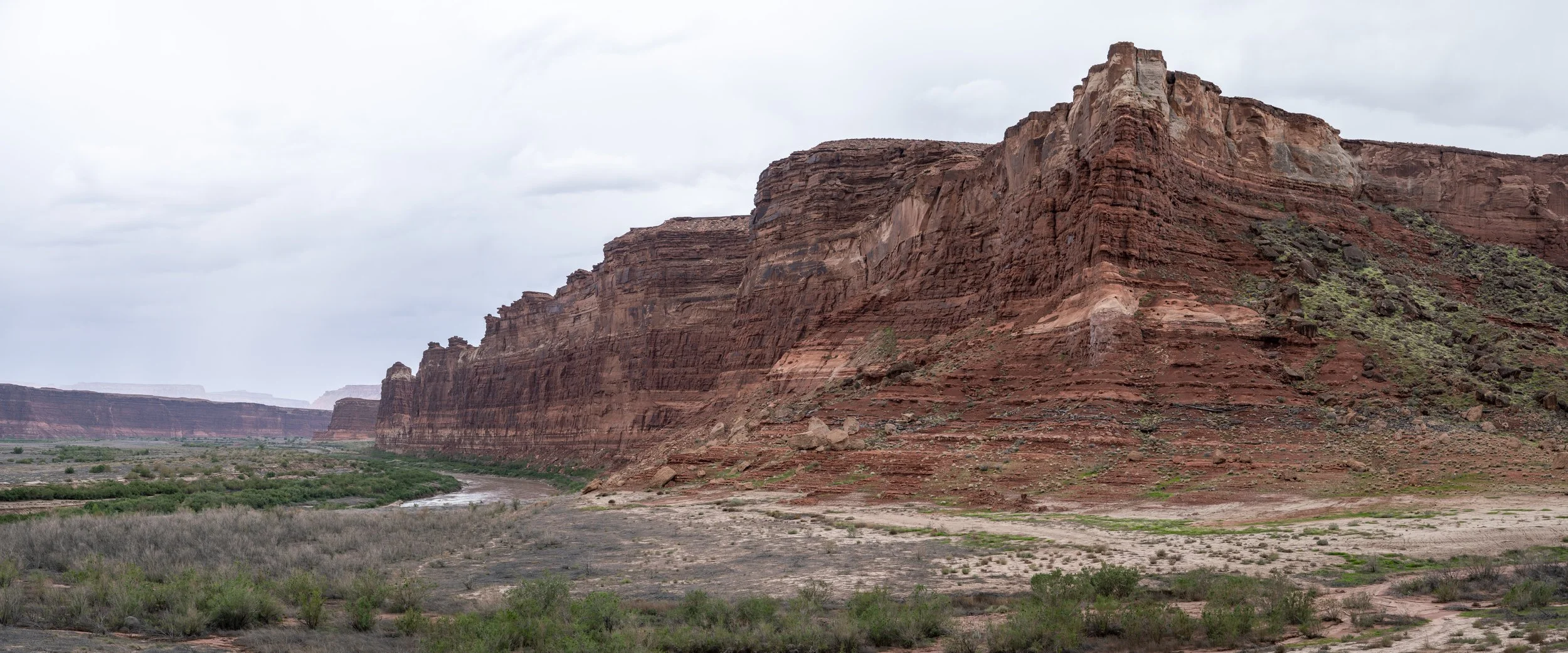
Hite, UT, October 2026. Driftwood along the canyon slopes indicates the previous high-water mark of Lake Powell.
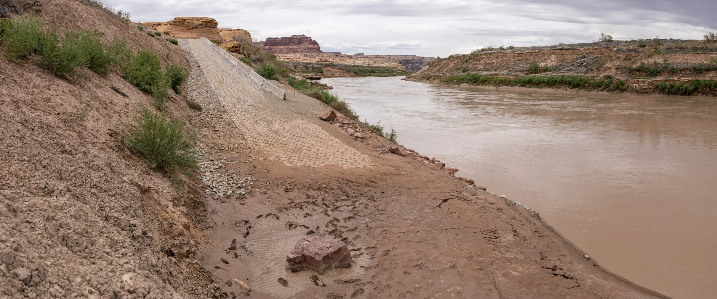
North Wash Boat Ramp, Hite, Utah. October 2026. Completed in June 2026 to maintain river access as Lake Powell's water levels declined, the temporary boat ramp now ends above the Colorado River's waterline. Higher on the surrounding canyon walls, the reservoir's former high-water marks reveal how dramatically the landscape has changed.
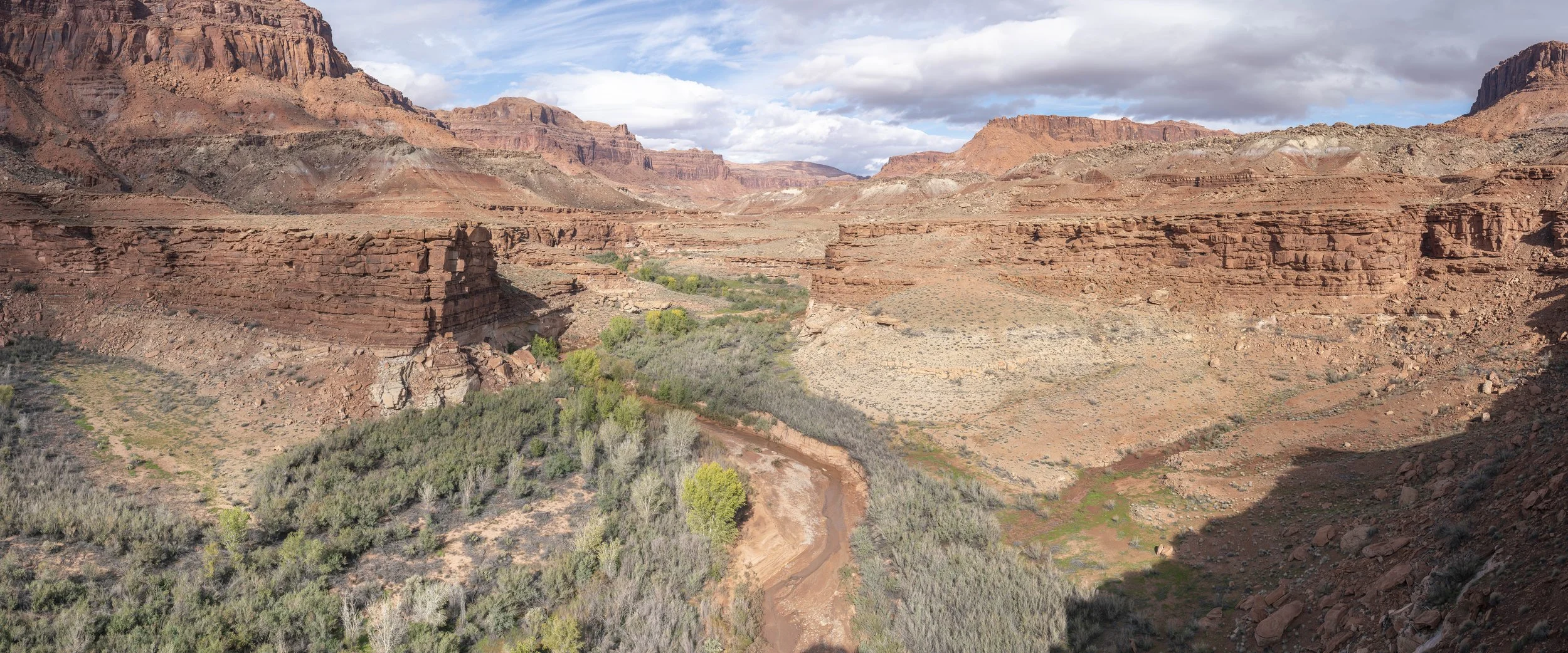
North Wash, Hite, UT, October 2026. A faint bathtub ring is visible; below it, vegetation returns to a canyon that was once underwater.
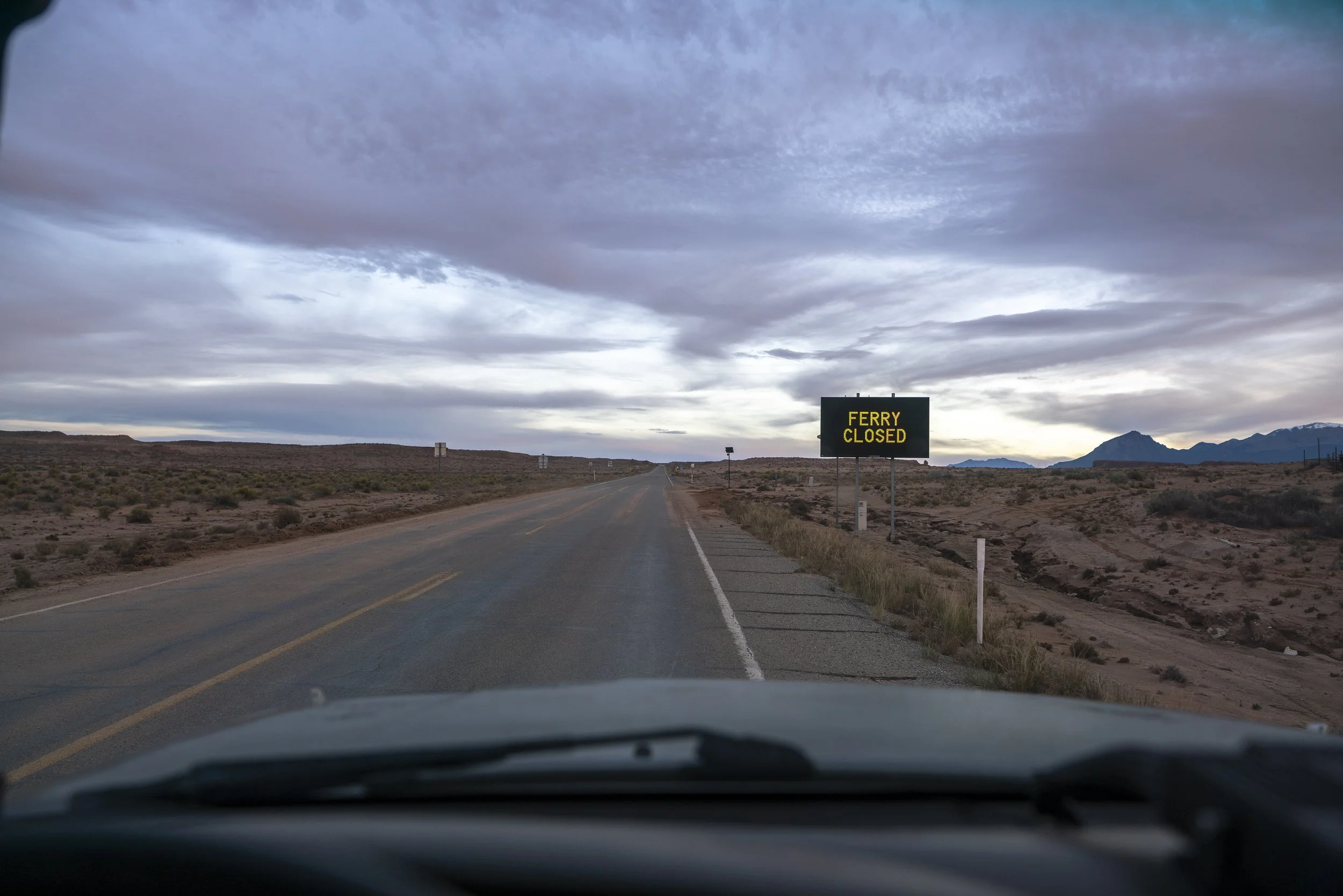
Hanksville, UT, October 2026. Bullfrog–Halls Crossing ferry has been closed since February 10, 2025
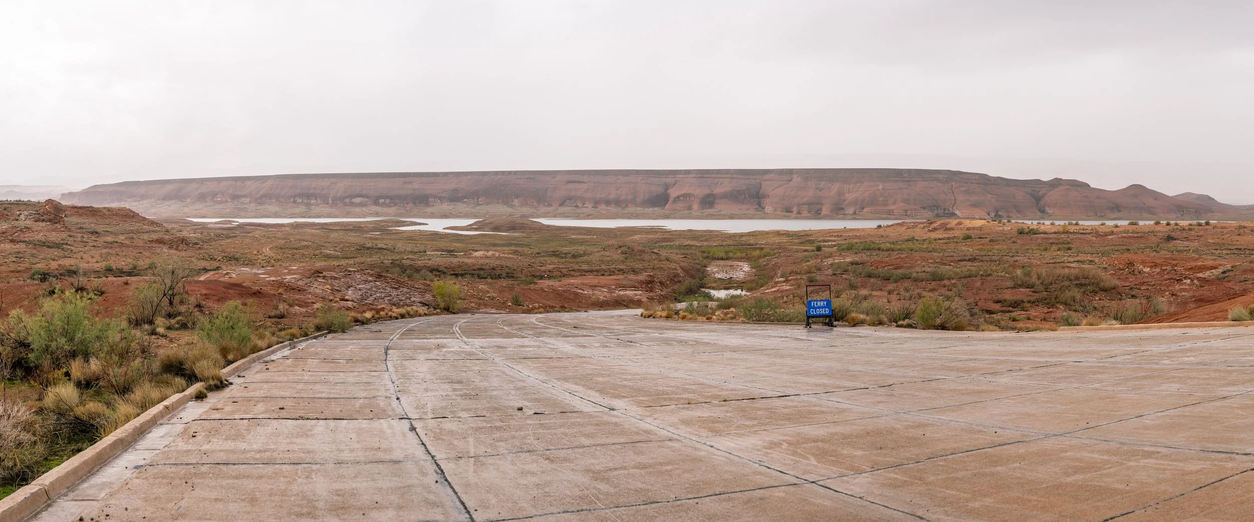
Bullfrog, Utah. October 2026. The ferry landing that once connected Bullfrog and Halls Crossing across Lake Powell. Ferry service was suspended in February 2025 due to declining reservoir levels, turning what was once a 30-minute crossing into an approximately 150-mile drive taking two and a half hours.
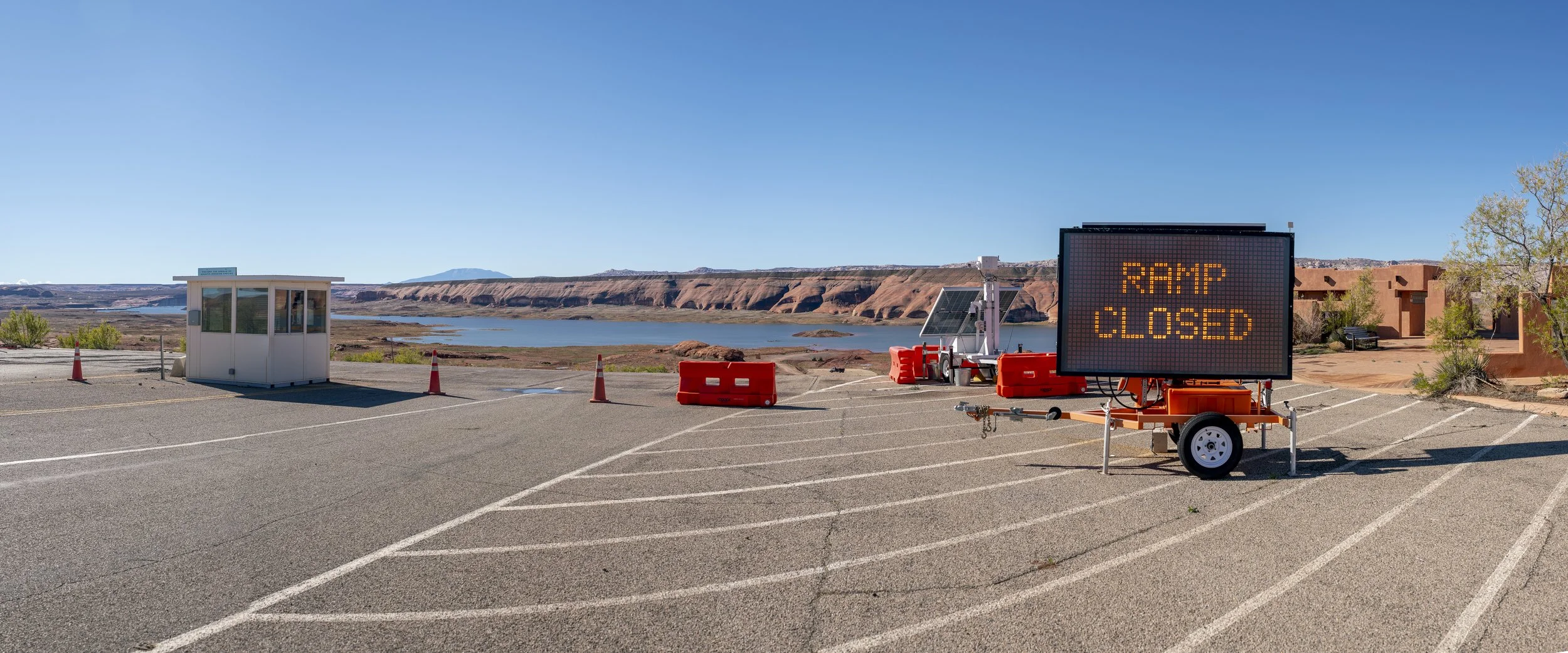
Bullfrog Main Boat Launch, Lake Powell. October 2026. Originally closed in February 2021 as reservoir levels declined, the launch briefly reopened during periods of higher water before becoming inoperable again in October 2024. Designed to operate above a reservoir elevation of approximately 3,578 feet, the ramp remains unusable for motorized vessels as Lake Powell continues to fluctuate well below that threshold.
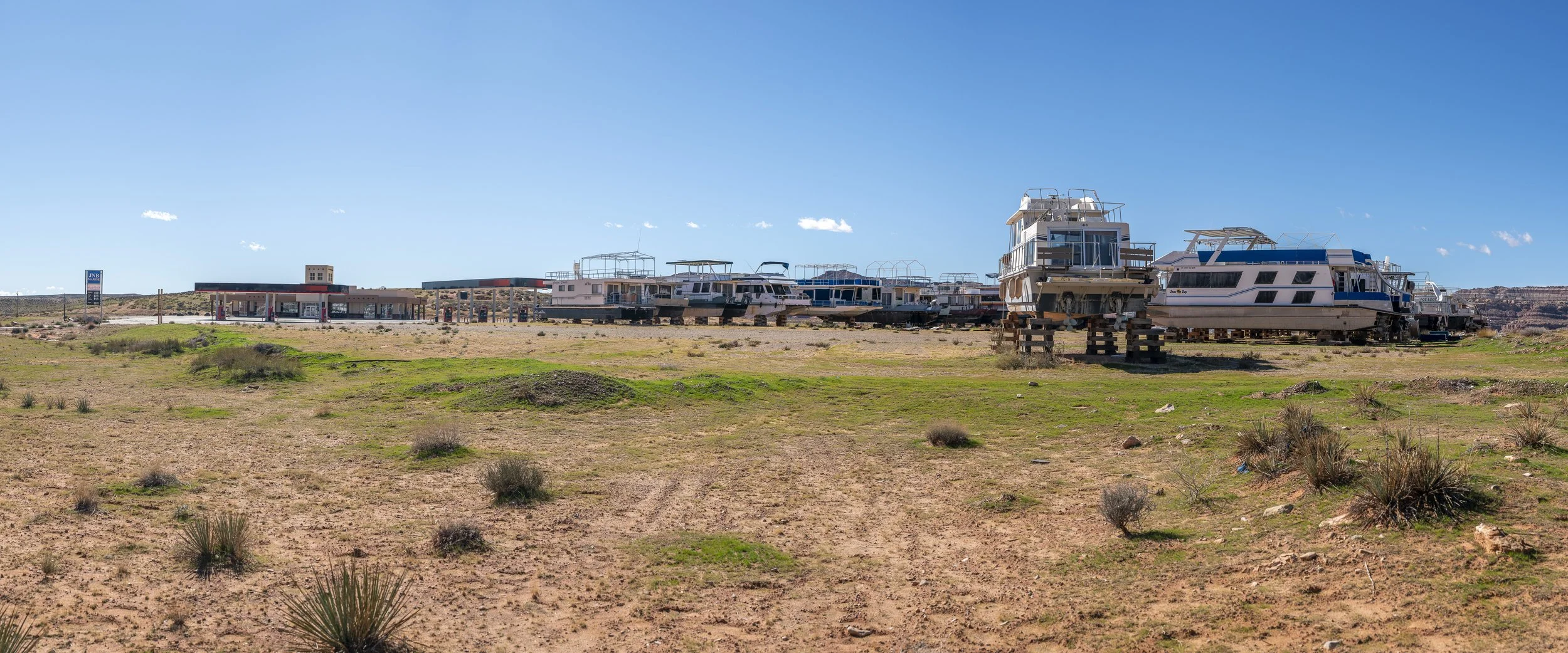
Ticaboo, Utah. November 2026. Houseboats removed from Lake Powell sit parked at a vacant fuel station, far from the water they once occupied.
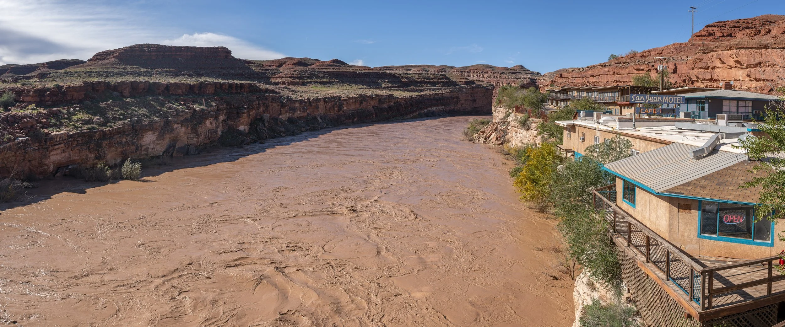
Mexican Hat, Utah. November 2026. A series of powerful autumn storms brought widespread flooding to the Four Corners region, sending a surge of water down the San Juan River and into Lake Powell.
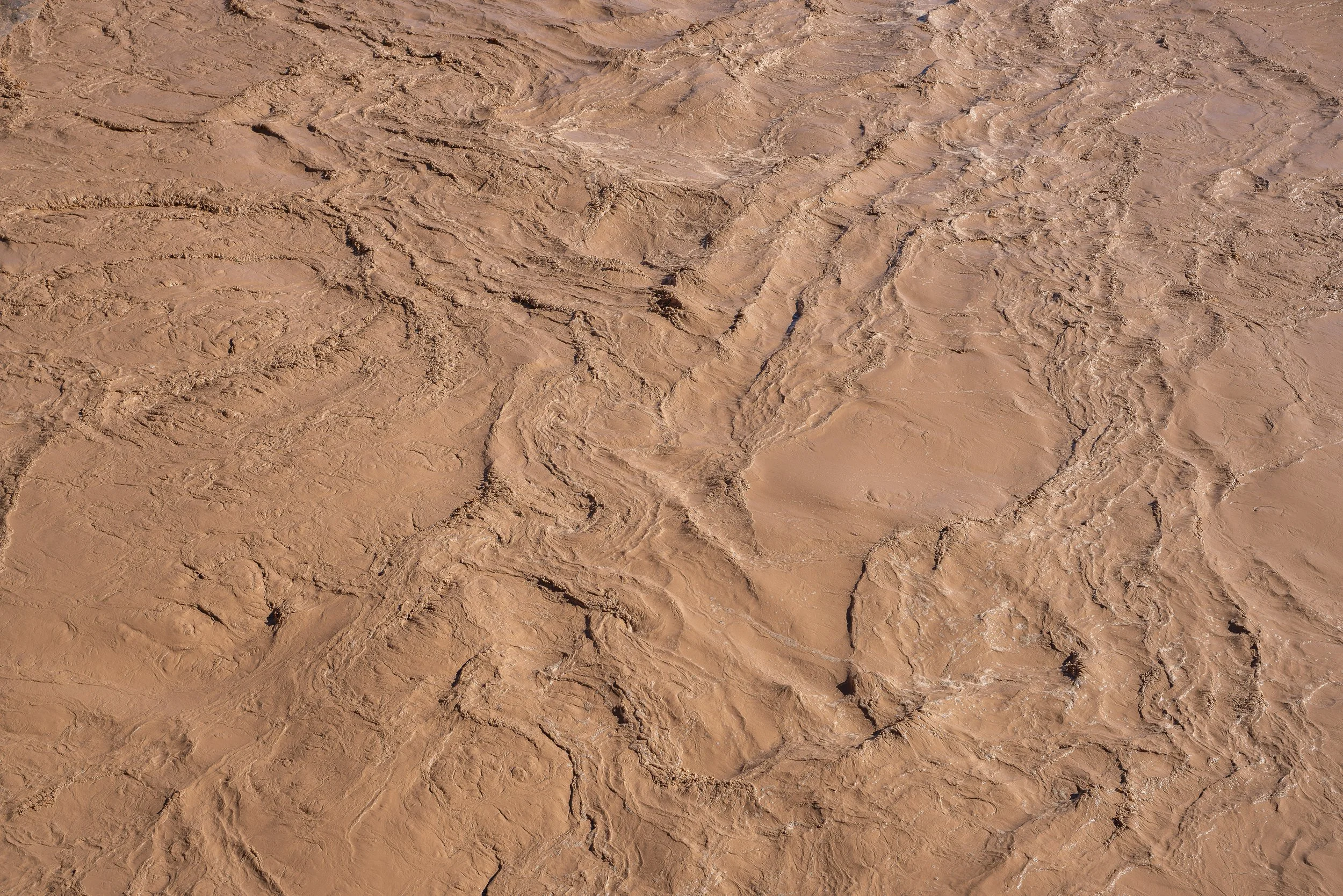
Mexican Hat, Utah. November 2026. Following a series of powerful autumn storms, floodwaters traveled down the San Juan River into Lake Powell. Between October 1 and November 6, the reservoir rose 19.77 feet. During this period, total inflow to Lake Powell peaked at a daily average of approximately 63,368 cubic feet per second on October 22.
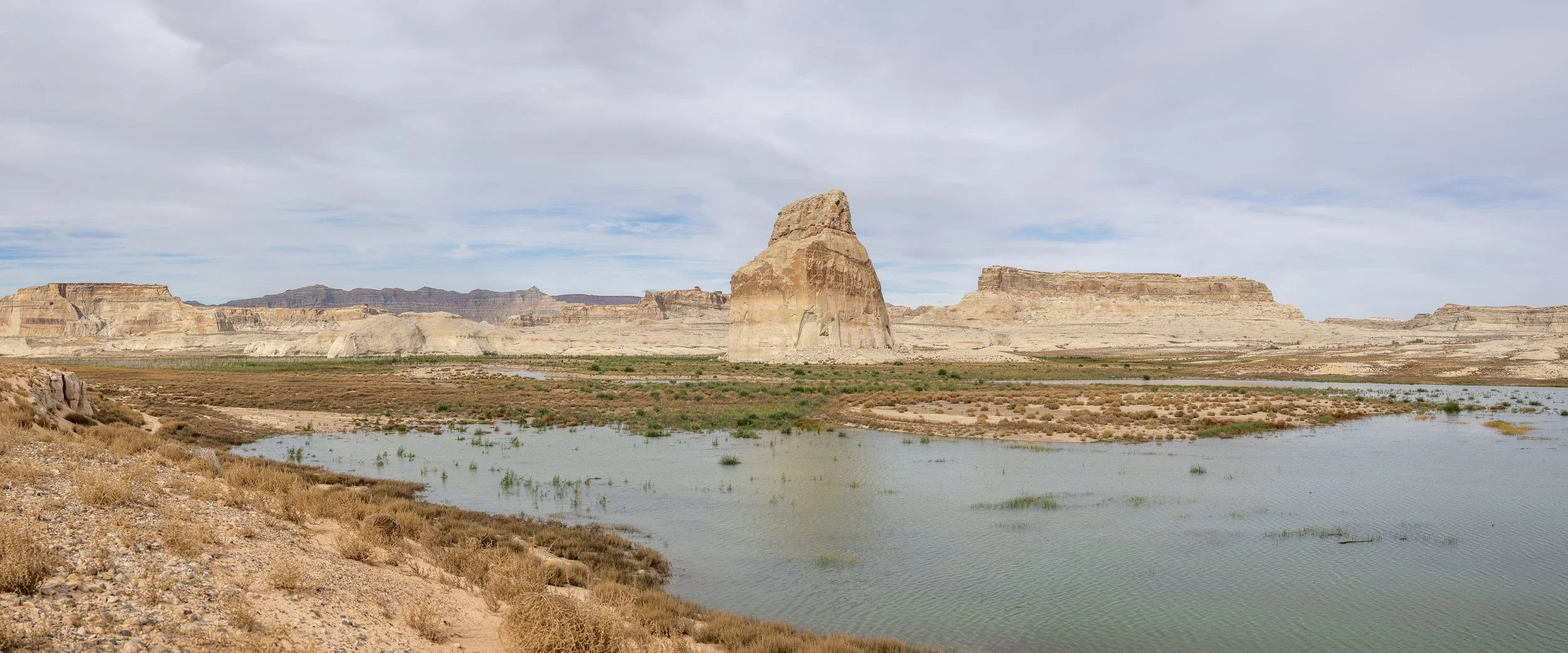
Lone Rock, Lake Powell, November 2026.
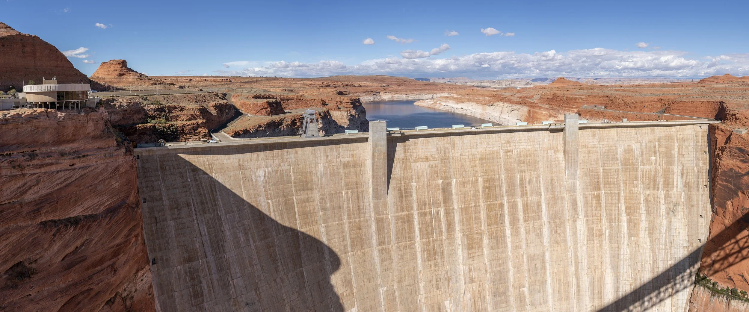
Glen Canyon Dam, Arizona. November 2026. Completed in 1963, Glen Canyon Dam impounds the Colorado River, creating Lake Powell, a vast water reserve intended to help the Upper Basin meet its downstream delivery obligations. As of November 6, 2026, the reservoir held approximately 6.33 million acre-feet of water, just 27% of its total capacity. During the 2026 water year, approximately 6 million acre-feet of water were released downstream. Yet throughout the Colorado River Basin, water consumption and losses continue to exceed the river's natural supply in most years, gradually depleting the reserves intended to sustain the region through periods of drought.
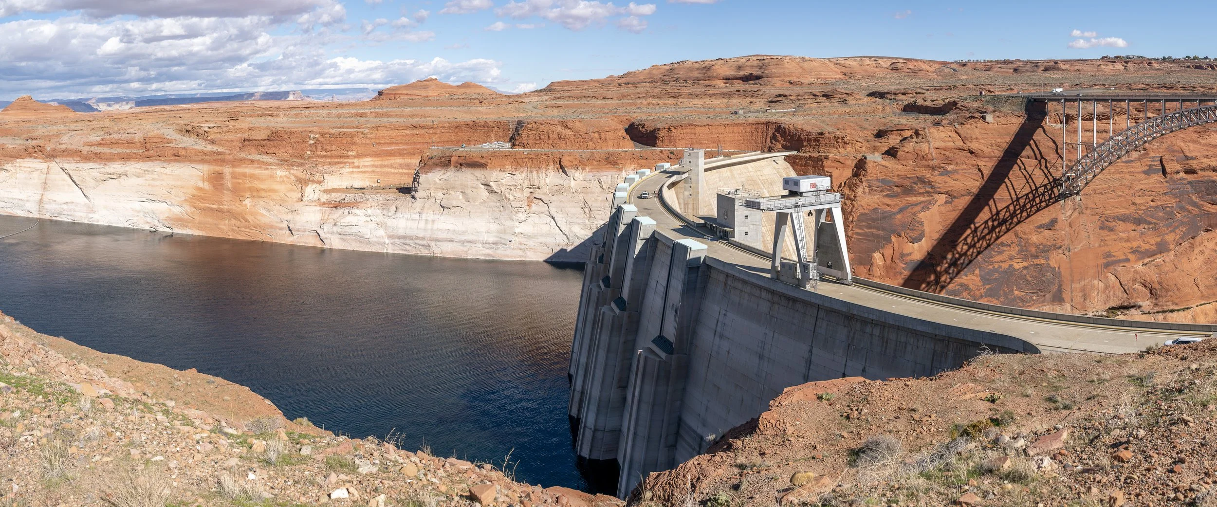
Glen Canyon Dam, Arizona. November 2026. Lake Powell's declining water levels have exposed a prominent white bathtub ring along the surrounding canyon walls. As of November 6, the reservoir stood approximately 162 feet below its normal full-pool elevation of 3,700 feet, revealing the extent to which the water has receded.
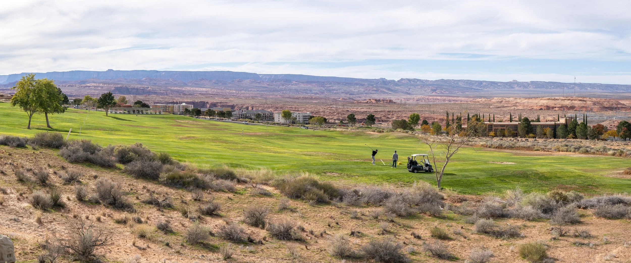
Page, Arizona. November 2025. A patch of artificially sustained green amid the vast desert landscape of the American Southwest. The Lake Powell National Golf Course is irrigated using treated municipal wastewater, part of a system that draws its original water supply from Lake Powell. Even this recreational landscape is connected to the Colorado River and the many competing demands placed upon its water.
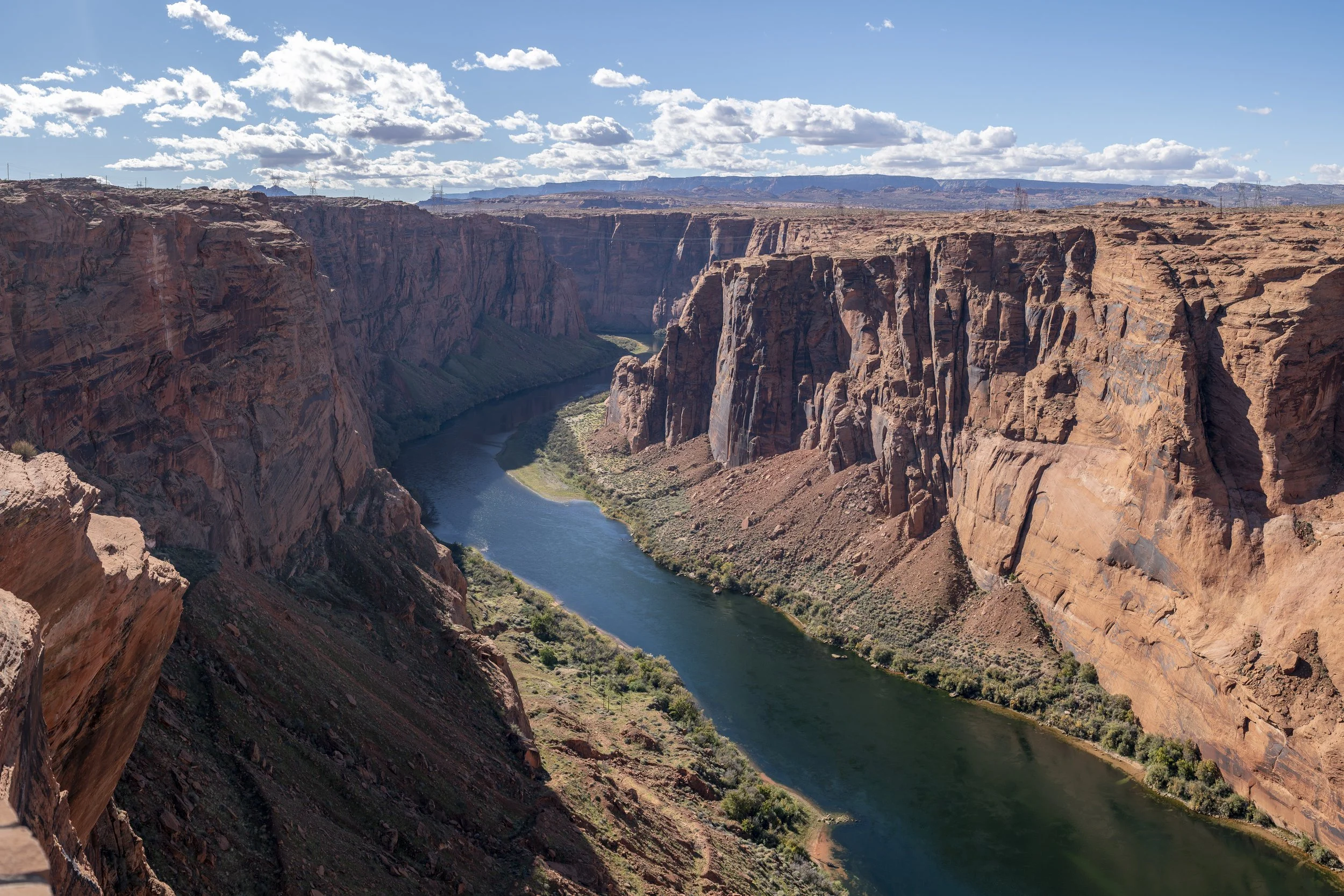
Page, Arizona. Below Glen Canyon Dam, the Colorado River flows largely clear of sediment. Historically, the river carried enormous quantities of sand and silt downstream, replenishing beaches, sandbars, and habitats throughout the Grand Canyon. Today, most of that sediment settles out in Lake Powell, leaving downstream tributaries to supply only a fraction of the river's historic sediment load.
…
UPDATED NOVEMBER 2026
Connect & Collaborate
This is an ongoing independent project, and we believe there is much to learn from the people and communities connected to the Colorado River Basin.
Whether you're personally connected to its waters, have a story or perspective to share, someone you'd recommend we speak with, resources or support to offer, or an idea for collaboration, we'd love to hear from you.
Every conversation has the potential to deepen our understanding and help shape where this project goes next.